


Hard skills like project management methodologies, budget analysis, and risk assessment techniques are essential for successfully leading projects.
Project Leader Resume Examples & Templates
Ready to elevate your career? Our project leader resume examples highlight leadership, strategic planning, and team management skills to help you stand out to employers.

by Gabriela Hernandez, Last Updated: January 18, 2026
Hired By:*

- Popular Project Leader Resume Examples
- Resume Template—Easy to Copy & Paste
- Build Your Resume in Minutes
- How to Write a Project Leader Resume Summary
- Showcasing Your Work Experience
- Top Skills to Include on Your Resume
- Resume Format Examples
- Related Management Resume Examples
- Frequently Asked Questions
- Should I include a cover letter with my project leader resume?
- Can I use a resume if I’m applying internationally, or do I need a CV?
- What soft skills are important for project leaders?
- I’m transitioning from another field. How should I highlight my experience?
- Where can I find inspiration for writing my cover letter as a project leader?
- How do I add my resume to LinkedIn?
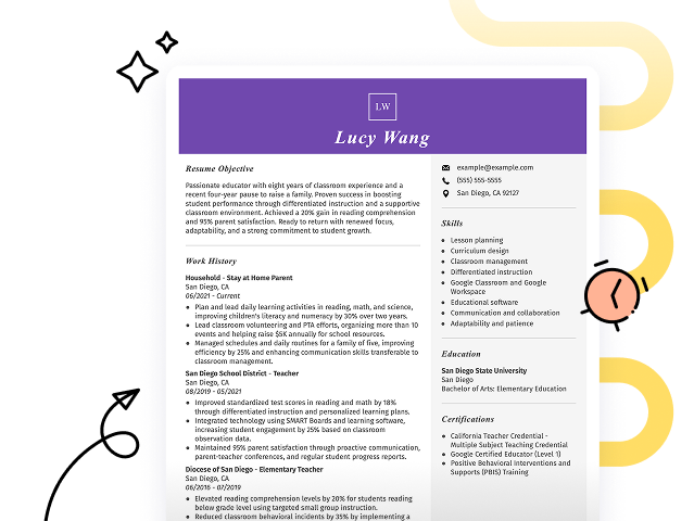
Popular Project Leader Resume Examples
Check out our top project leader resume examples that emphasize key skills like strategic planning, team management, and effective communication. These examples will guide you in showcasing your accomplishments to attract hiring managers.
Ready to build an impressive resume? Our Resume Builder offers user-friendly templates designed specifically for project leaders, helping you shine in your job applications.
Recommended
 Customize This Resume
Project leader resume
What this resume does well:
The resume features a polished layout and a professional resume fonts selection that improves readability. These design choices highlight the applicant's accomplishments while conveying a sense of professionalism, making a strong impression on potential employers in the project management field.
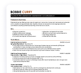
Project manager resume
What this resume does well:
This resume effectively balances vital skills such as agile methodologies and budget management with relevant work experience. By presenting these abilities alongside concrete examples of past projects, employers can clearly assess the job seeker's skill in leading teams and optimizing operations while achieving successful outcomes.
Senior project manager resume
What this resume does well:
This resume skillfully uses bullet points to clearly outline significant achievements and responsibilities, allowing hiring managers to quickly grasp the job seeker's impact. The consistent formatting and ample white space create an organized appearance that highlights key qualifications without clutter, making it easy to read at a glance.
Resume Template—Easy to Copy & Paste
Example
Chris Singh
Chicago, IL 60602
(555)555-5555
Chris.Singh@example.com
Professional Summary
Results-driven Project Leader with 7 years of experience leading 2M+ projects, boosting productivity by 30%, and enhancing stakeholder engagement.
Work History
Project Leader
Innovative Solutions Inc. - Chicago, IL
January 2023 - November 2025
- Led projects with 2M+ budgets
- Boosted team productivity by 30%
- Streamlined processes, reducing overages by 15%
Project Manager
TechWave Systems - Springfield, IL
January 2019 - December 2022
- Managed cross-functional teams of 15
- Increased project delivery speed by 25%
- Implemented Agile methodologies
Project Coordinator
Future Innovators Co. - Chicago, IL
January 2018 - December 2018
- Facilitated project schedules for 5 projects
- Maintained 98% client satisfaction rate
- Improved resource allocation efficiency
Skills
- Project Management
- Agile Methodologies
- Team Leadership
- Risk Management
- Resource Planning
- Budget Management
- Process Improvement
- Stakeholder Engagement
Certifications
- PMP Certification - Project Management Institute
- Certified Scrum Master - Scrum Alliance
Education
Master of Science Project Management
Massachusetts Institute of Technology Cambridge, MA
June 2017
Bachelor of Science Business Administration
University of California, Berkeley Berkeley, CA
June 2015
Languages
- Spanish - Beginner (A1)
- French - Intermediate (B1)
- German - Beginner (A1)
Build Your Resume in Minutes
Creating a custom resume is easier than ever with our Resume Builder!
How to Write a Project Leader Resume Summary
Your resume summary is the first opportunity to grab an employer's attention, making it important that you effectively showcase your qualifications. As a project leader, you should highlight your leadership skills, project management experience, and ability to drive results in diverse teams.
This profession thrives on showcasing your ability to lead projects successfully while collaborating with stakeholders at all levels. Focus on demonstrating your strategic thinking and problem-solving skills in this section.
To guide you in crafting an effective summary, here are some examples that illustrate what works well and what to avoid:
Weak Example
I am a project leader with extensive experience in managing various projects. I seek a position where I can use my skills and help the company achieve its goals. A team-oriented environment that values collaboration and innovation is what I’m looking for. I believe I would be a great addition to your organization if given the chance.
Why this summary misses the mark:
- Lacks specific details about past achievements or leadership style, making it generic
- Overuses personal pronouns and vague terms, which dilute the impact of the message
- Concentrates on personal desires rather than emphasizing valuable contributions to potential employers
Strong Example
Results-oriented project leader with 8+ years of experience managing cross-functional teams in the tech industry. Successfully led a software development project that increased client satisfaction by 25% and reduced delivery times by 20%. Expert in Agile methodologies, project lifecycle management, and stakeholder communication.
Why this summary works:
- Begins with a clear statement of experience and industry
- Highlights quantifiable achievements that show impact on team performance and client outcomes
- Mentions specific methodologies and skills relevant to project management roles
Pro Tip
If you're starting your career and lack formal experience, consider using a career objective. This approach allows you to highlight your enthusiasm and skills. Many resume objective examples tailored to your field are available to guide you in crafting a strong statement.
Showcasing Your Work Experience
The work experience section is important for your resume as a project leader, and it will contain the majority of your content. Good resume templates always emphasize this important area.
This section should be organized chronologically, detailing your previous roles in reverse order. Use bullet points to highlight key achievements and contributions made during each position.
To further illustrate effective practices, we’ll present a couple of examples that showcase strong work history entries for project leaders. These examples will clarify what stands out and what doesn’t.
Weak Example
Project Leader
Innovate Solutions – San Francisco, CA
- Led team meetings.
- Managed project timelines.
- Coordinated with stakeholders.
- Oversaw project documentation.
Why this work experience section misses the mark:
- Lacks specific dates of employment
- Bullet points are too generic and do not highlight achievements
- Focuses on routine tasks without measurable outcomes
Strong Example
Project Leader
Tech Innovations Inc. – San Francisco, CA
March 2020 - Present
- Lead a cross-functional team of 10 in the development and launch of a new software product, achieving a 30% increase in client satisfaction within the first quarter post-launch.
- Implemented agile methodologies that streamlined project timelines by 20%, improving overall team productivity.
- Facilitated workshops for stakeholders to gather requirements, ensuring all project goals aligned with business objectives and reducing scope creep.
Why this work experience section works:
- Starts each bullet point with effective action verbs that highlight significant contributions
- Incorporates specific metrics to demonstrate tangible results from the job seeker's efforts
- Showcases relevant skills such as leadership and collaboration essential for a Project Leader role
While your resume summary and work experience are important elements, don't overlook the importance of other sections that also need careful formatting. For further insights, refer to our complete guide on how to write a resume.
Top Skills to Include on Your Resume
A well-defined skills section is important for any project leader's resume as it allows you to quickly highlight your qualifications and demonstrate your ability to meet the demands of the role.
Strengthen your application by highlighting a combination of hard and soft skills on your resume.
Discover more about hard skills and how they contribute to effective project leadership. Soft skills such as leadership, effective communication, and problem-solving abilities foster team collaboration and drive project success in a dynamic environment. Learn how soft skills improve teamwork and adaptability in ever-changing workplaces.
When selecting your resume skills, it’s essential to align them with the expectations of potential employers and the automated screening systems they often use. Highlighting relevant skills increases your chances of catching a recruiter’s eye and passing through initial filters.
To effectively prioritize your skills, review job postings carefully. They often provide valuable insights into which abilities are most sought after, helping you tailor your resume to meet both recruiter needs and ATS criteria.
Pro Tip
Ensure your resume stands out in a crowded job market by using our ATS Resume Checker. It will help you pinpoint over 30 common mistakes, allowing your application to sail past applicant tracking systems with ease.
10 skills that appear on successful project leader resumes
Showcasing high-demand skills can significantly improve your resume, making it more appealing to recruiters in the project management field. You can find examples of these skills effectively illustrated in our resume examples, which empower you to apply with confidence.
By the way, here are 10 essential skills you should consider including on your resume if they align with your experience and job requirements:
Leadership
Time management
Problem-solving
Risk assessment
Team collaboration
Budgeting and cost control
Agile methodology
Stakeholder engagement
Adaptability
Communication
Based on analysis of 5,000+ management professional resumes from 2023-2024
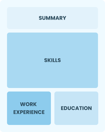
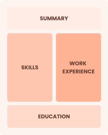
Resume Format Examples
Choosing the right resume format is important for project leaders because it highlights essential leadership skills, relevant experiences, and career advancements effectively to potential employers.
Entry-Level 0 - 2 years
Functional
Focuses on skills rather than previous jobs
Best for:
Recent graduates and career changers with up to two years of experience
Mid-Career 3 - 7 years
Combination
Balances skills and work history equally
Best for:
Mid-career professionals focused on demonstrating their skills and advancing their careers
Experienced 8+ years
Chronological
Emphasizes work history in reverse order
Best for:
Seasoned leaders in healthcare management or advanced clinical practice
Frequently Asked Questions
Should I include a cover letter with my project leader resume?
Absolutely. Including a cover letter can significantly improve your application by showcasing your personality and enthusiasm for the role. It allows you to highlight specific experiences that align with the job requirements. If you need assistance, our guide on how to write a cover letter can provide valuable tips, or use our Cover Letter Generator for quick help in crafting your document.
Can I use a resume if I’m applying internationally, or do I need a CV?
For international roles, a CV is often preferred over a resume. Explore our resources on how to write a CV to understand the ideal format and content for global applications, ensuring you present your skills effectively. Additionally, reviewing various CV examples can provide insight into crafting a strong application tailored for international opportunities.
What soft skills are important for project leaders?
Soft skills such as communication, problem-solving, and adaptability are essential for project leaders. These interpersonal skills foster collaboration among team members, promote a positive work environment, and ensure that projects run smoothly by effectively addressing challenges as they arise.
I’m transitioning from another field. How should I highlight my experience?
When applying for project leader roles, highlight your transferable skills such as team collaboration, strategic planning, and effective communication. These abilities illustrate your potential to drive projects forward, even if your background isn't in project management. Share specific instances where you've led initiatives or solved challenges that align with the responsibilities of a project leader.
Where can I find inspiration for writing my cover letter as a project leader?
If you're applying for project leader roles, consider exploring our curated collection of cover letter examples. These samples provide valuable insights into effective content ideas, formatting tips, and ways to showcase your qualifications confidently.
How do I add my resume to LinkedIn?
To improve your resume's visibility on LinkedIn, you should add your resume to LinkedIn by uploading it to your profile or highlighting key achievements in the "About" and "Experience" sections. This approach helps recruiters easily find qualified project leaders and connect with you for potential opportunities.

Ready to land the job?
Join 28M+ others who've built a resume that works.