


Mastering hard skills is essential for a coordinator, including project management, skill in scheduling software, and data analysis to ensure efficient operations.
Coordinator Resume Examples & Templates
Looking to stand out as a coordinator? Our coordinator resume examples will help you showcase your organizational skills, communication abilities, and project management experience that employers seek.

by Gabriela Hernandez, Last Updated: January 18, 2026
Hired By:*

- Popular Coordinator Resume Examples
- Resume Template—Easy to Copy & Paste
- Build Your Resume in Minutes
- How to Write a Coordinator Resume Summary
- Showcasing Your Work Experience
- Top Skills to Include on Your Resume
- Resume Format Examples
- Coordinator Salaries in the Highest-Paid States
- Related Administrative Resume Examples
- Frequently Asked Questions
- Should I include a cover letter with my coordinator resume?
- Can I use a resume if I’m applying internationally, or do I need a CV?
- What soft skills are important for coordinators?
- I’m transitioning from another field. How should I highlight my experience?
- How do I write a resume with no experience?
- How do I add my resume to LinkedIn?
Popular Coordinator Resume Examples
Check out our top coordinator resume examples that showcase skills such as project management, communication, and teamwork. These samples will help you effectively highlight your achievements and experience.
Ready to build your own impressive resume? Our Resume Builder offers user-friendly templates designed specifically for coordinators, making it simple for you to stand out in the hiring process.
Recommended
 Customize This Resume
Entry-level coordinator resume
What this resume does well:
This entry-level resume effectively highlights the applicant's project management skills and successful team leadership experiences, showcasing their ability to improve efficiency and client satisfaction in previous roles. New professionals must demonstrate their capabilities in strategic planning and resource allocation through quantifiable achievements, even when work experience is limited.
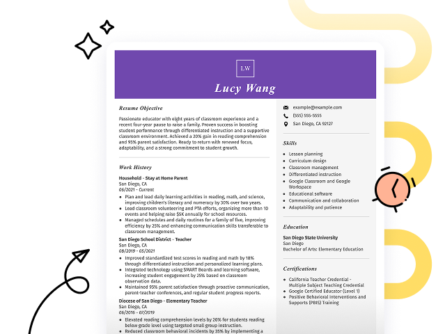
Mid-career coordinator resume
What this resume does well:
This resume effectively showcases the job seeker's extensive qualifications, emphasizing their leadership in project management and event coordination. The clear presentation of accomplishments and skills illustrates readiness for higher responsibilities, reflecting a strong career trajectory and commitment to excellence.
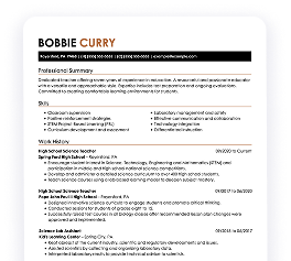
Experienced coordinator resume
What this resume does well:
This resume's work history section illustrates the applicant's extensive experience as a coordinator, demonstrating their success in managing cost reduction projects and improving workflows. The clear formatting with bullet points allows for quick identification of quantifiable achievements, appealing to hiring managers seeking efficient job seekers.
Resume Template—Easy to Copy & Paste
Example
Tao Nguyen
Miami, FL 33106
(555)555-5555
Tao.Nguyen@example.com
Skills
- Event Planning
- Budget Management
- Vendor Coordination
- Team Leadership
- Client Relations
- Project Management
- Process Improvement
- Operational Efficiency
Languages
- Spanish - Beginner (A1)
- French - Intermediate (B1)
- German - Beginner (A1)
Professional Summary
Experienced Coordinator with 5 years in event planning, team leadership, and budget management. Proven track record of increasing client satisfaction by 25% and reducing cost overruns by 10%. Proficient in streamlining processes for operational efficiency.
Work History
Coordinator
Sunrise Events Management - Miami, FL
January 2023 - October 2025
- Coordinated over 200 corporate events annually.
- Improved client satisfaction rate by 25%.
- Managed budgets up to 0K per event.
Event Planning Assistant
BlueSky Conferences - Tampa, FL
May 2021 - December 2022
- Assisted in planning 50+ large-scale events.
- Reduced cost overruns by 10%.
- Liaised with vendors to ensure timely delivery.
Administrative Coordinator
NextGen Solutions - Tampa, FL
January 2020 - April 2021
- Streamlined office processes, cutting downtime by 15%.
- Managed schedules for a team of 25.
- Created reports that improved operational insights.
Certifications
- Certified Meeting Professional (CMP) - Events Industry Council
- Project Management Professional (PMP) - Project Management Institute
Education
Master's Business Administration
University of California Los Angeles, CA
June 2019
Bachelor's Marketing
New York University New York, NY
May 2017
Build Your Resume in Minutes
Creating a custom resume is easier than ever with our Resume Builder!
How to Write a Coordinator Resume Summary
Your resume summary is the first impression hiring managers have of you, making it important to convey your qualifications effectively. As a coordinator, it’s essential to highlight your organizational skills, project management experience, and ability to communicate with diverse teams.
This profession should showcase your capacity to streamline processes and ensure projects run smoothly. Emphasizing these strengths will set you apart from other applicants.
To illustrate what makes an effective resume summary, review the following examples that demonstrate both successful strategies and common pitfalls:
Weak Example
I am an experienced coordinator with a broad range of skills and a strong work ethic. I'm seeking a position where I can use my abilities and contribute positively to the company. A team environment that values collaboration and growth is important to me. I believe my background will be beneficial if given the chance.
Why this summary misses the mark:
- Contains vague phrases about experience without showcasing specific achievements or skills
- Relies heavily on personal language, which detracts from professionalism
- Emphasizes what the job seeker desires in a role rather than detailing how they can add value to the employer
Strong Example
Detail-oriented coordinator with over 7 years of experience in managing project timelines and cross-functional teams. Successfully improved project delivery times by 20% through the implementation of streamlined communication protocols and resource management strategies. Proficient in project management software, data analysis, and stakeholder engagement to ensure alignment with organizational goals.
Why this summary works:
- Starts with specific years of experience and key responsibilities relevant to coordinator roles
- Highlights quantifiable achievements that showcase effectiveness in improving processes
- Mentions relevant technical skills that are critical for a coordinator position, demonstrating capability to potential employers
Pro Tip
If you're new to the job market and don't have much formal experience, consider using a career objective. This can highlight your goals and enthusiasm effectively. To get started on the right foot, look for resume objective examples tailored to your field.
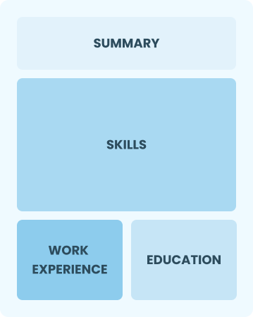
Showcasing Your Work Experience
The work experience section plays a important role in your resume as a coordinator, serving as the central focus of your content. Resume templates consistently incorporate this essential area to emphasize your relevant experience.
Organize this section in reverse-chronological order, detailing your past positions. Use bullet points to clearly present your achievements and responsibilities in each role you've undertaken.
To offer insight into creating an effective work history section, we will share examples that demonstrate best practices and highlight common pitfalls.
Weak Example
Event Coordinator
City Events Ltd. – Austin, TX
- Organized events for clients
- Communicated with vendors and clients
- Handled logistics and schedules
- Managed a team during events
Why this work experience section misses the mark:
- Lacks specific achievements or measurable outcomes
- Bullet points are overly simplistic and do not highlight unique skills
- Does not provide any context about the types of events coordinated or their scale
Strong Example
Project Coordinator
Tech Innovations Inc. – San Francisco, CA
March 2021 - Present
- Facilitate project meetings and ensure timely communication among stakeholders, leading to a 30% reduction in project delays
- Implement project tracking tools that improved team productivity by 40%, improving overall workflow efficiency
- Coordinate cross-departmental collaboration for project launches, achieving successful completion of five major initiatives within budget and timeline
Why this work experience section works:
- Starts each bullet with dynamic action verbs showcasing the applicant’s contributions
- Incorporates specific metrics to highlight the impact of the applicant’s efforts on team performance
- Demonstrates relevant skills like communication and coordination essential for a coordinator role
While your resume summary and work experience are important components, don’t overlook the importance of other sections. Each part plays a role in showcasing your skills and qualifications. For more detailed assistance, visit our comprehensive guide on how to write a resume.
Top Skills to Include on Your Resume
A skills section is an important part of your resume as it quickly shows potential employers that you possess the necessary qualifications for the coordinator role. By highlighting your strengths, it makes it easy for hiring managers to see how you can contribute to their team.
For coordinators, hard skills and soft skills are equally important. Ensure you showcase a balanced mix of these two types of skills in your resume. Employers will see that you're an industry expert and an efficient professional.
Developing soft skills like communication, problem-solving, and teamwork plays a key role in facilitating smooth collaboration among team members and ensuring successful project outcomes.
Choosing the right resume skills is important for aligning with employer expectations. Many organizations use automated systems to filter applicants based on these essential skills, making it important to match what they seek.
When you aim to effectively showcase your abilities, review job postings closely. They often highlight specific skills that will grab the attention of both recruiters and applicant tracking systems (ATS), ensuring your resume stands out in a competitive job market.
Pro Tip
To make sure your resume grabs the attention of hiring managers, use our ATS Resume Checker. It identifies over 30 common errors, helping you optimize your application and boost your chances of getting noticed.
10 skills that appear on successful coordinator resumes
Improve your resume’s appeal to recruiters by highlighting essential skills that are in high demand for coordinator roles. These sought-after abilities are illustrated in our resume examples, giving you the edge needed to secure interviews.
Here are 10 key skills you should think about incorporating into your resume if they align with your experience and job specifications:
Project management
Effective communication
Time management
Attention to detail
Problem-solving
Interpersonal skills
Flexibility and adaptability
Team collaboration
Data analysis
Skill in Microsoft Office Suite
Based on analysis of 5,000+ administrative professional resumes from 2023-2024
Resume Format Examples
Selecting the appropriate resume format is important for showcasing your coordination skills, previous roles, and advancement in the field. This approach ensures potential employers see your most relevant qualifications at a glance.
Entry-Level 0 - 2 years
Functional
Focuses on skills rather than previous jobs
Best for:
Recent graduates and career changers with up to two years of experience
Mid-Career 3 - 7 years
Combination
Balances skills and work history equally
Best for:
Mid-career coordinators focused on demonstrating their skills and pursuing growth opportunities
Experienced 8+ years
Chronological
Emphasizes work history in reverse order
Best for:
Skilled leaders with extensive experience in healthcare coordination
Coordinator Salaries in the Highest-Paid States
Our coordinator salary data is based on figures from the U.S. Bureau of Labor Statistics (BLS), the authoritative source for employment trends and wage information nationwide.
Whether you're entering the workforce or considering a move to a new city or state, this data can help you gauge what fair compensation looks like for coordinators in your desired area.
$0$55K$110K
Frequently Asked Questions
Should I include a cover letter with my coordinator resume?
Absolutely, including a cover letter can significantly improve your application. It allows you to showcase your personality and elaborate on how your skills align with the job. If you need assistance crafting a strong cover letter, explore our comprehensive guide on how to write a cover letter or use our Cover Letter Generator for quick help.
Can I use a resume if I’m applying internationally, or do I need a CV?
When applying for jobs outside the U.S., a CV is often required instead of a resume, especially in Europe and Asia. To ensure your CV meets international standards, explore our CV examples that demonstrate effective formatting. Additionally, you can learn more about how to write a CV with our comprehensive resources.
What soft skills are important for coordinators?
Soft skills such as communication, problem-solving, and teamwork are essential for coordinators. These interpersonal skills enable effective collaboration with team members and stakeholders, fostering strong relationships that improve project success and create a positive work environment.
I’m transitioning from another field. How should I highlight my experience?
Highlight your transferable skills such as organization, communication, and adaptability, which are essential in a coordinator role. Even if you have limited experience in this specific field, these abilities can showcase your potential to excel. Share concrete examples from past jobs that illustrate how you've successfully managed projects or collaborated with teams to achieve goals.
How do I write a resume with no experience?
If you're applying for coordinator positions with limited experience, highlight your organizational skills, project involvement, and any leadership roles in community activities. Learn how to write a resume with no experience to better showcase your ability to collaborate and communicate effectively. Employers value enthusiasm and a willingness to learn, so let your passion shine through in your application. You can make a strong impression without extensive work history.
How do I add my resume to LinkedIn?
To improve your resume’s visibility on LinkedIn, you can add your resume to LinkedIn by uploading it to your profile or featuring key accomplishments in the "About" and "Experience" sections. This approach helps recruiters and hiring managers quickly find qualified applicants like you, increasing your chances for networking and job opportunities.

Ready to land the job?
Join 28M+ others who've built a resume that works.