


Hard skills include navigation, vehicle operation, and logistics management, which are essential for transportation professionals to ensure timely and safe delivery of goods.
Transportation Resume Examples & Templates
Looking to drive your career forward? Our transportation resume examples showcase skills like logistics management and safety compliance to help you stand out to employers.

by Gabriela Hernandez, Last Updated: January 18, 2026
Hired By:*

- Popular Transportation Resume Examples
- Resume Template—Easy to Copy & Paste
- Build Your Resume in Minutes
- How to Write a Transportation Resume Summary
- Showcasing Your Work Experience
- Top Skills to Include on Your Resume
- Resume Format Examples
- Transportation Salaries in the Highest-Paid States
- Related Transportation Resume Examples
- Frequently Asked Questions
- Should I include a cover letter with my transportation resume?
- Can I use a resume if I’m applying internationally, or do I need a CV?
- What soft skills are important for transportations?
- I’m transitioning from another field. How should I highlight my experience?
- Where can I find inspiration for writing my cover letter as a transportation?
- Should I use a cover letter template?
Popular Transportation Resume Examples
Check out our top transportation resume examples that emphasize key skills such as logistics management, route optimization, and safety compliance. These examples demonstrate how to effectively showcase your accomplishments to potential employers.
Ready to build a standout resume? Our Resume Builder offers user-friendly templates designed specifically for transportation professionals, helping you make a strong impression in your job search.
Recommended
 Customize This Resume
Logistics coordinator resume
What this resume does well:
The resume's clean formatting and professional resume fonts choices improve readability, allowing key accomplishments in logistics to stand out clearly. These design elements make a strong impression by showcasing the applicant's attention to detail and commitment to presenting information effectively.
Fleet manager resume
What this resume does well:
This resume effectively integrates skills like fleet management and route optimization with substantial work experience. By demonstrating these competencies in practical settings, employers can gain confidence in this job seeker's ability to improve logistics efficiency and manage resources efficiently.
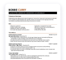
Dispatcher resume
What this resume does well:
This resume effectively uses clear bullet points to summarize extensive experience, enabling hiring managers to quickly identify major accomplishments. The strategic use of spacing and consistent formatting ensures that critical qualifications stand out, making it easy to assess the job seeker's fit for transportation roles at a glance.
Resume Template—Easy to Copy & Paste
Example
Sophia Miller
Oakridge, OR 97469
(555)555-5555
Sophia.Miller@example.com
Skills
- Route Optimization
- Fleet Management
- Cost Reduction
- Safety Training
- Inventory Control
- Logistics Supervision
- Team Leadership
- Performance Enhancement
Languages
- Spanish - Beginner (A1)
- French - Beginner (A1)
- Mandarin - Beginner (A1)
Professional Summary
Experienced Transportation Professional specializing in route optimization, fleet management, and cost reduction. Proven track record in logistics supervision and team leadership.
Work History
Transportation
Summit Freight Lines - Oakridge, OR
January 2023 - December 2025
- Managed non-stop route optimization, increasing efficiency by 20%
- Executed cost-saving measures, reducing expenditures by ,000
- Coordinated fleet operations, enhancing delivery times by 15%
Logistics Supervisor
Horizon Logistics - Portland, OR
January 2020 - December 2022
- Supervised logistics team, improving performance by 10%
- Implemented tracking systems, boosting accuracy by 25%
- Enhanced inventory procedures, saving ,000 annually
Transport Coordinator
BlueLine Transport - Portland, OR
January 2017 - December 2019
- Scheduled routes, improving delivery times by 30%
- Optimized resource use, reducing waste by 40%
- Led safety training, reducing incidents by 50%
Certifications
- Certified Transportation Professional - National Transportation Institute
- Logistics Management Certification - Logistics Institute
Education
Master's Transportation Management
University of Southern California Los Angeles, California
December 2016
Bachelor's Logistics
California State University Los Angeles, California
December 2013
Build Your Resume in Minutes
Creating a custom resume is easier than ever with our Resume Builder!
How to Write a Transportation Resume Summary
Your resume summary is the first thing employers will notice, making it important to create a strong and memorable impression. In this section, you should highlight your key skills and experiences that align with the transportation industry, showcasing your ability to meet job demands.
As a transportation professional, focus on essential attributes such as safety compliance, efficiency in logistics, and effective communication. These elements are vital to demonstrating your qualifications and suitability for various roles within this field.
To help you grasp what makes an powerful summary, we’ll present examples that illustrate both successful approaches and common pitfalls:
Weak Example
I am an experienced transportation professional with many years in the industry. I am seeking a position that will allow me to use my skills and contribute to the company’s goals. I value teamwork and hope for a supportive environment that encourages development.
Why this summary misses the mark:
- Contains vague claims about experience without specific achievements or skills
- Relies heavily on personal language, which can dilute professionalism
- Emphasizes what the job seeker seeks rather than showcasing how they can benefit the employer
Strong Example
Experienced transportation manager with over 8 years in logistics and supply chain management, focusing on optimizing route efficiency and reducing operational costs. Achieved a 20% reduction in delivery times through advanced route planning software and implemented cost-saving measures that decreased fuel expenses by 15%. Proficient in fleet management systems, regulatory compliance, and team leadership to ensure seamless operations.
Why this summary works:
- Begins with specific experience level and focus area in transportation management
- Includes quantifiable achievements that highlight measurable improvements in efficiency and cost savings
- Showcases relevant technical skills and leadership capabilities valued in the transportation industry
Pro Tip
If you're just starting out and lack formal transportation experience, consider using a career objective to showcase your enthusiasm and goals. There are many resume objective examples tailored to the transportation field that can guide you in crafting a compelling statement.
Showcasing Your Work Experience
The work experience section is the cornerstone of your resume in transportation, where you'll provide the bulk of your content. Good resume templates always prioritize this section to ensure it's clearly visible.
This area should be organized in reverse-chronological order, allowing you to present your previous roles effectively. Use bullet points to highlight key achievements and responsibilities for each position you've held in the transportation field.
Now, let's look at a couple of examples that illustrate what makes a strong work history entry for transportation professionals. These examples will show you what works and what doesn't work:
Weak Example
Delivery Driver
Fast Freight Services – Los Angeles, CA
- Delivered packages to various locations
- Followed delivery routes and schedules
- Interacted with customers during deliveries
- Maintained vehicle cleanliness
Why this work experience section misses the mark:
- No details about the employment dates
- Bullet points lack specifics on achievements or metrics
- Focuses on routine tasks without highlighting impact or efficiency
Strong Example
Logistics Coordinator
Global Transport Solutions – Atlanta, GA
March 2020 - Current
- Oversee the shipment of goods across the country, ensuring timely delivery and adherence to safety regulations
- Implement a new tracking system that reduced delays by 30%, improving customer satisfaction
- Train and mentor junior staff in logistics software and best practices, resulting in a more efficient team
Why this work experience section works:
- Starts each bullet with compelling action verbs, clearly showcasing the applicant’s contributions
- Incorporates specific metrics to highlight achievements effectively
- Demonstrates relevant skills and experiences that align with industry expectations
While your resume summary and work experience are important components, don’t overlook the importance of other sections. Each part contributes to a well-rounded presentation. For more detailed guidance on crafting a complete resume, explore our comprehensive guide on how to write a resume.
Top Skills to Include on Your Resume
A well-crafted skills section is important for any resume as it provides a clear snapshot of what you bring to the table. This allows job seekers to highlight their strengths while giving employers a quick reference point for essential qualifications.
Hiring managers appreciate this direct approach, enabling them to swiftly evaluate applicant suitability against job specifications. Transportation professionals should emphasize both their technical skills and interpersonal abilities, which will be detailed further below.
Soft skills are important for transportation professionals as they improve communication, teamwork, and problem-solving, ensuring safe and efficient operations in a dynamic environment.
When crafting your resume skills, it's important to align them with what employers expect. Many organizations use automated systems to filter out applicants who lack the essential skills for the position.
To improve your chances of being noticed, review job postings carefully. These listings often highlight the specific skills you should prioritize to appeal both to recruiters and applicant tracking systems (ATS).
Pro Tip
Make sure your resume grabs the attention of employers by using our ATS Resume Checker. This tool spots over 30 common mistakes, assisting your application in smoothly navigating past applicant tracking software.
10 skills that appear on successful transportation resumes
Improve your resume to attract recruiters by highlighting essential skills in the transportation field. Our resume examples showcase these high-demand abilities, ensuring you submit applications with the confidence that a polished resume provides.
Here are 10 key skills you should consider incorporating into your resume if they align with your qualifications and job expectations:
Time management
Attention to detail
Safety compliance
Customer service
Navigation skill
Vehicle maintenance knowledge
Problem-solving abilities
Team collaboration
Adaptability to changing conditions
Logistics planning
Based on analysis of 5,000+ transportation professional resumes from 2023-2024
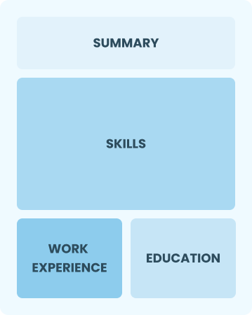
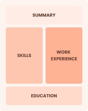
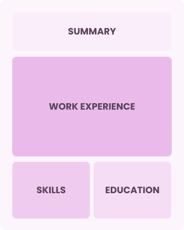
Resume Format Examples
Choosing the proper resume format is important because it highlights your most relevant transportation skills and experiences, effectively illustrating your career journey to potential employers.
Entry-Level 0 - 2 years
Functional
Focuses on skills rather than previous jobs
Best for:
Recent graduates and career changers with up to two years of experience
Mid-Career 3 - 7 years
Combination
Balances skills and work history equally
Best for:
Mid-career professionals focused on demonstrating their skills and growth potential
Experienced 8+ years
Chronological
Emphasizes work history in reverse order
Best for:
Seasoned leaders driving innovation in transportation logistics
Transportation Salaries in the Highest-Paid States
Our transportation salary data is based on figures from the U.S. Bureau of Labor Statistics (BLS), the authoritative source for employment trends and wage information nationwide.
Whether you're entering the workforce or considering a move to a new city or state, this data can help you gauge what fair compensation looks like for transportations in your desired area.
$0$80K$160K
Frequently Asked Questions
Should I include a cover letter with my transportation resume?
Absolutely, including a cover letter is essential as it allows you to showcase your unique qualifications and enthusiasm for the position. A well-crafted cover letter can make a strong impression on hiring managers. If you’re not sure how to write a cover letter, explore our comprehensive resources or use our Cover Letter Generator for step-by-step assistance.
Can I use a resume if I’m applying internationally, or do I need a CV?
When applying for jobs abroad, use a CV instead of a resume as it is often required in many countries. To help you create an effective CV, explore these CV examples that showcase proper formatting. Additionally, learn how to write a CV with techniques tailored to international standards.
What soft skills are important for transportations?
Soft skills like communication, adaptability, and problem-solving are important in transportation. These interpersonal skills enable professionals to coordinate effectively with teams, manage logistics smoothly, and improve customer interactions, fostering positive relationships in the industry.
I’m transitioning from another field. How should I highlight my experience?
Highlight your transferable skills such as communication, organization, and teamwork when applying for transportation roles. These abilities show your value even if you don’t have direct experience in the field. Share specific examples from past jobs that demonstrate how you've successfully managed logistics or worked with others to achieve goals related to transportation tasks.
Where can I find inspiration for writing my cover letter as a transportation?
If you're pursuing a career in transportation, consider exploring our professionally crafted cover letter examples. These samples can provide valuable content ideas, formatting tips, and guidance on showcasing your qualifications effectively to stand out in your applications.
Should I use a cover letter template?
Using a cover letter template specifically tailored for transportation roles can improve the structure and organization of your content. This effectively highlights key skills like logistics management and route optimization, ensuring that your achievements resonate with hiring managers who are looking for efficient and skilled job seekers.

Ready to land the job?
Join 28M+ others who've built a resume that works.