


Technical abilities such as blueprint reading, construction project management, and skill in using heavy machinery are considered hard skills essential for ensuring safety and efficiency on job sites.
Construction Resume Examples & Templates
Looking to boost your career in construction? Our construction resume examples showcase how to emphasize skills like project management and teamwork, helping you stand out to employers.

by Gabriela Hernandez, Last Updated: January 18, 2026
Hired By:*

- Popular Construction Resume Examples
- Resume Template—Easy to Copy & Paste
- Build Your Resume in Minutes
- How to Write a Construction Resume Summary
- Showcasing Your Work Experience
- Top Skills to Include on Your Resume
- Resume Format Examples
- Construction Salaries in the Highest-Paid States
- Related Construction Resume Examples
- Frequently Asked Questions
- Should I include a cover letter with my construction resume?
- Can I use a resume if I’m applying internationally, or do I need a CV?
- What soft skills are important for construction resumes?
- I’m transitioning from another field. How should I highlight my experience?
- Should I use a cover letter template?
- How do I add my resume to LinkedIn?
Popular Construction Resume Examples
Check out our top construction resume examples that highlight essential skills such as project management, safety compliance, and teamwork. These examples are designed to help you present your experience effectively to potential employers.
Ready to build your standout resume? Our Resume Builder offers user-friendly templates specifically crafted for professionals in the construction industry, making your job application process smoother.
Recommended
 Customize This Resume
Construction worker resume
What this resume does well:
The resume features a clear layout and resume fonts that improve readability and organization. This thoughtful design helps the early-career construction professional effectively showcase their skills and accomplishments, making a strong impression on potential employers.
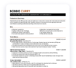
General laborer resume
What this resume does well:
This resume effectively integrates skills like inventory management and safety protocols with hands-on experience. By showcasing these abilities alongside a history of improving efficiency and maintaining safety, employers can clearly see the job seeker's capability to improve operations in construction environments.
Construction technician resume
What this resume does well:
This resume uses bullet points effectively to present key accomplishments and responsibilities, making it easy for hiring managers to identify the applicant's extensive experience. The well-structured layout and ample spacing help maintain clarity while emphasizing critical qualifications without cluttering the page.
Resume Template—Easy to Copy & Paste
Example
Christian Rivera
Jersey City, NJ 07306
(555)555-5555
Christian.Rivera@example.com
Skills
- Project Management
- Team Leadership
- Construction Safety
- Blueprint Reading
- Quality Control
- Cost Estimation
- Time Management
- Problem-Solving
Certifications
- Certified Construction Manager - Construction Management Association of America
- OSHA 30-Hour Construction Safety - Occupational Safety and Health Administration
Languages
- Spanish - Beginner (A1)
- French - Intermediate (B1)
- German - Beginner (A1)
Professional Summary
Experienced construction professional with expertise in project management and safety protocols. Proven track record of completing projects within budget and timeline, enhancing operational efficiency, and implementing sustainable practices. Fluent in Spanish with a strong foundation in team leadership and quality control.
Work History
Construction
Skyline Builders - Jersey City, NJ
October 2023 - October 2025
- Supervised 12 construction projects to timely completion.
- Increased project efficiency by 15% reducing overall costs.
- Implemented safety protocols, reducing incident rates by 10%.
Construction Project Manager
UrbanRise Construction - Maplewood, NJ
October 2021 - September 2023
- Directed construction of 8 commercial buildings.
- Boosted team productivity by 20% through streamlined processes.
- Managed budgets, saving 100,000 annually.
Site Supervisor
Pacific Development Group - Jersey City, NJ
October 2020 - September 2021
- Oversaw daily operations on 5 construction sites.
- Reduced material waste by 15% via efficient practices.
- Achieved project deadlines within 90% of initial timelines.
Education
Master's Degree Construction Management
University of California, Los Angeles Los Angeles, California
May 2019
Bachelor's Degree Civil Engineering
University of Southern California Los Angeles, California
May 2017
Build Your Resume in Minutes
Creating a custom resume is easier than ever with our Resume Builder!
How to Write a Construction Resume Summary
Your resume summary is the first opportunity to capture an employer's attention, so it’s important to make a lasting impression. This section should effectively showcase your skills and experiences that align with the construction role you’re targeting.
As a construction professional, you should highlight your expertise in project management, safety compliance, and hands-on experience in various trades. These elements will set you apart from other applicants and demonstrate your value to potential employers.
To better understand how to craft an powerful resume summary, consider the following examples that illustrate both effective and ineffective approaches:
Weak Example
I am a dedicated construction worker with years of experience in the industry. I want to find a position where I can use my skills and contribute positively to the company. A job that offers stability and good benefits is what I’m looking for, as I believe this will help me perform better.
Why this summary misses the mark:
- Lacks specific examples of skills or achievements relevant to construction
- Overly focused on personal desires rather than what value the job seeker adds to potential employers
- Uses generic language that fails to convey passion or expertise within the construction field
Strong Example
Results-driven construction manager with over 10 years of experience leading large-scale residential and commercial projects. Successfully completed a $5 million development project ahead of schedule and under budget, achieving a 20% reduction in material costs through strategic vendor negotiations. Proficient in project management software, budgeting, and safety compliance regulations.
Why this summary works:
- Begins with clear experience level and specific areas of expertise in construction
- Highlights quantifiable achievements that showcase effective project management and cost-saving measures
- Mentions relevant technical skills that are essential for success in construction roles
Pro Tip
If you're just starting out in construction and lack formal experience, consider using a career objective on your resume. This approach can highlight your enthusiasm and skills rather than focusing solely on job history. You can find plenty of resume objective examples to help you craft the perfect statement.
Showcasing Your Work Experience
The work experience section is important for your construction resume, as it will contain the majority of your content. Good resume templates always include this section to highlight your skills and experiences effectively.
This part should be organized in reverse-chronological order, listing previous jobs and responsibilities. Use bullet points to outline specific achievements and contributions you made on each project.
Let’s examine a couple of examples that demonstrate effective work history for professionals in construction. These examples will help you understand what stands out and what to avoid:
Weak Example
Construction Laborer
ABC Construction Co. – Atlanta, GA
- Assisted in various construction tasks.
- Helped with equipment maintenance.
- Followed safety protocols on site.
- Worked alongside skilled tradespeople.
Why this work experience section misses the mark:
- Lacks specific details about job responsibilities and projects
- Bullet points are too general without showcasing individual contributions
- Does not highlight any achievements or skills gained during employment
Strong Example
Construction Supervisor
ABC Construction Co. – Denver, CO
March 2020 - Current
- Oversee daily operations on large-scale construction sites, ensuring adherence to safety protocols and project timelines.
- Coordinate with subcontractors and suppliers, resulting in a 30% reduction in material costs over the last year.
- Implement quality control measures that increased project efficiency by 20%, leading to faster completion rates.
Why this work experience section works:
- Starts each bullet point with powerful action verbs that highlight achievements
- Incorporates specific metrics to showcase effectiveness and impact clearly
- Demonstrates relevant skills through concrete examples of accomplishments
While your resume summary and work experience are important, don’t overlook the importance of other sections. Each part contributes to showcasing your qualifications effectively. For detailed tips on crafting your entire resume, check out our comprehensive guide on how to write a resume.
Top Skills to Include on Your Resume
A well-structured skills section is important for any construction resume. It allows you to showcase the qualifications that match job requirements, making it easier for employers to see your fit for the role.
In construction, highlight both technical skills and soft skills. Include examples like skill in tools such as power saws, knowledge of safety regulations, and experience with team and project management.
Meanwhile, soft skills, including teamwork, communication, and problem-solving capabilities, foster collaboration among workers and contribute to successful project outcomes.
Selecting the right resume skills is important for aligning with what employers expect from a job seeker. Many organizations use automated screening systems to filter out applicants who lack essential skills for the position.
To ensure your resume stands out, carefully review job postings to identify which skills are emphasized. This strategy will help you highlight relevant abilities that appeal to both recruiters and ATS systems, increasing your chances of getting noticed.
Pro Tip
Ensure your resume stands out to hiring managers by using the ATS Resume Checker. This tool can pinpoint over 30 common mistakes, helping you optimize your document to navigate applicant tracking systems successfully.
10 skills that appear on successful construction resumes
Highlighting essential skills on your resume is important for attracting recruiters in the construction field. These high-demand skills can set you apart, and you can see how they are presented in our resume examples to help you apply confidently.
Here are 10 skills you should consider including in your resume if they fit your qualifications and role requirements:
Blueprint reading
Project management
Safety compliance
Team collaboration
Problem-solving
Heavy equipment operation
Time management
Attention to detail
Physical endurance
Knowledge of building codes
Based on analysis of 5,000+ construction professional resumes from 2023-2024
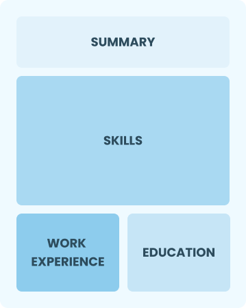
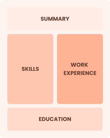
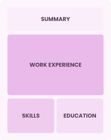
Resume Format Examples
Selecting the appropriate resume format in construction highlights your technical skills, work history, and project accomplishments efficiently.
Entry-Level 0 - 2 years
Functional
Focuses on skills rather than previous jobs
Best for:
Recent graduates and career changers with up to two years of experience
Mid-Career 3 - 7 years
Combination
Balances skills and work history equally
Best for:
Mid-career professionals seeking to show their skills and potential for growth
Experienced 8+ years
Chronological
Emphasizes work history in reverse order
Best for:
Experienced leaders excelling in complex construction project management
Construction Salaries in the Highest-Paid States
Our construction salary data is based on figures from the U.S. Bureau of Labor Statistics (BLS), the authoritative source for employment trends and wage information nationwide.
Whether you're entering the workforce or considering a move to a new city or state, this data can help you gauge what fair compensation looks like for constructions in your desired area.
$0$80K$160K
Frequently Asked Questions
Should I include a cover letter with my construction resume?
Absolutely! Including a cover letter can significantly improve your application by showcasing your personality and detailing how your skills align with the job. It provides an opportunity to explain any unique circumstances in your career journey. If you need assistance crafting yours, check out our comprehensive guide on how to write a cover letter or use our Cover Letter Generator for quick results.
Can I use a resume if I’m applying internationally, or do I need a CV?
When seeking job opportunities abroad, a CV is often preferred over a resume due to its detailed format. To ensure you understand the specific requirements of your target country, explore our resources on how to write a CV and formatting. These guides, including various CV examples, will help you craft an effective CV that stands out.
What soft skills are important for construction resumes?
Soft skills like communication, teamwork, and problem-solving are essential in construction. These interpersonal skills foster collaboration among team members and ensure safety on site, ultimately leading to successful project completion and strong professional relationships.
I’m transitioning from another field. How should I highlight my experience?
When applying for construction roles, highlight transferable skills such as teamwork, project management, and attention to detail. These abilities demonstrate your readiness to adapt to the new environment, even if your background isn't directly in construction. Use specific examples from your past work to illustrate how these strengths relate to tasks like site coordination or safety compliance.
Should I use a cover letter template?
Yes, improving your presentation can be achieved by using a cover letter template tailored for construction roles. It provides a clear structure that effectively organizes your skills and experiences, such as project management and safety compliance, for hiring managers.
How do I add my resume to LinkedIn?
To improve your resume's visibility on LinkedIn, add your resume to LinkedIn by uploading it directly to your profile or emphasizing key skills and projects in the "About" and "Experience" sections. This approach assists construction recruiters in easily discovering qualified applicants and connecting with you for potential job opportunities.

Ready to land the job?
Join 28M+ others who've built a resume that works.