


Hard skills include technical competencies such as drone operation, navigation systems skill, and data analysis capabilities to ensure safe and effective flight missions.
Drone Pilot Resume Examples & Templates
Looking to elevate your career as a drone pilot? Our drone pilot resume examples showcase essential skills like aerial navigation and data analysis that will help you stand out to employers.

by Gabriela Hernandez, Last Updated: January 18, 2026
Hired By:*

- Popular Drone Pilot Resume Examples
- Resume Template—Easy to Copy & Paste
- Build Your Resume in Minutes
- How to Write a Drone Pilot Resume Summary
- Showcasing Your Work Experience
- Top Skills to Include on Your Resume
- Resume Format Examples
- Related Aviation Resume Examples
- Frequently Asked Questions
- Should I include a cover letter with my drone pilot resume?
- Can I use a resume if I’m applying internationally, or do I need a CV?
- What soft skills are important for drone pilots?
- I’m transitioning from another field. How should I highlight my experience?
- Where can I find inspiration for writing my cover letter as a drone pilot?
- Should I use a cover letter template?
Popular Drone Pilot Resume Examples
Check out our top drone pilot resume examples that emphasize key skills like aerial navigation, flight planning, and regulatory compliance. These examples are designed to help you effectively showcase your unique accomplishments in the field.
Ready to build your ideal resume? Our Resume Builder offers user-friendly templates specifically crafted for drone pilots, making it simple to create a standout application.
Recommended
 Customize This Resume
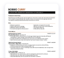
Entry-level drone pilot resume
What this resume does well:
This entry-level resume for a drone pilot effectively highlights the job seeker's practical experience with UAV operations and their ability to improve project efficiency. It showcases impressive accomplishments such as a 98% client satisfaction rate. New professionals in this field must demonstrate technical competencies, certifications, and a proactive approach to safety and innovation despite limited direct work history.
Mid-career drone pilot resume
What this resume does well:
This resume effectively showcases the job seeker's qualifications through quantifiable achievements and relevant experience. By highlighting leadership in aerial surveys and technical skills, it clearly positions them for advanced roles within the drone industry, reflecting a strong career trajectory.
Experienced drone pilot resume
What this resume does well:
The work experience section highlights the applicant's expertise in drone operations, showcasing achievements like executing 400+ search & rescue missions and reducing survey time by 30%. Bullet points improve clarity for quick assessment.
Resume Template—Easy to Copy & Paste
Example
Daniel Patel
Riverview, FL 33587
(555)555-5555
Daniel.Patel@example.com
Skills
- Drone Navigation
- Aerial Photography
- Flight Route Planning
- Data Analysis
- Drone Maintenance
- Remote Sensing
- Safety Protocols
- Regulatory Compliance
Certifications
- Advanced Drone Operations - Drone Institute of America
- Remote Pilot Certification - Federal Aviation Administration
Languages
- Spanish - Beginner (A1)
- German - Intermediate (B1)
- French - Beginner (A1)
Professional Summary
Experienced Drone Pilot skilled in aerial data analytics and route optimization. Expertise in engineering-driven UAV design and safe operations, enhancing project delivery.
Work History
Lead Drone Pilot
SkyVision Aerial Services - Riverview, FL
September 2023 - October 2025
- Captured aerial shots boosting sales by 20%
- Devised drone routes reducing flight time by 15%
- Integrated AI models increasing project accuracy
Remote Aircraft Operator
Phoenix Aero Solutions - Tampa, FL
May 2021 - August 2023
- Optimized mapping workflows for 3% efficiency
- Executed drone missions cutting costs by ,000
- Supervised technical setup raising project success
UAV Technician
AeroTech Dynamics - Tampa, FL
March 2020 - April 2021
- Conducted diagnostic tests saving 10% in repairs
- Streamlined maintenance improving drone lifespan
- Collaborated with engineers enhancing design
Education
Master of Science Aerospace Engineering
University of Arizona Tucson, Arizona
June 2020
Bachelor of Science Mechanical Engineering
Arizona State University Tempe, Arizona
June 2018
Build Your Resume in Minutes
Creating a custom resume is easier than ever with our Resume Builder!
How to Write a Drone Pilot Resume Summary
Your resume summary is the first opportunity to capture employers' attention, making it essential to present your skills effectively. As a drone pilot, emphasize your technical expertise and ability to operate various unmanned aerial vehicles safely.
Highlight key qualifications such as flight experience, familiarity with regulations, and skill in aerial photography or surveying techniques. These elements will demonstrate your value and readiness for the role.
To illustrate what makes an effective summary, review the following examples that showcase both strong and weak approaches:
Weak Example
I am a dedicated drone pilot with some experience and skills in flying drones. I hope to find a job that allows me to use my abilities effectively while working in a positive environment. A role that offers flexibility and room for personal development would be great. I believe I can contribute positively if given the chance.
Why this summary misses the mark:
- Lacks specific details about the applicant's experience and skills, making it hard for employers to gauge qualifications
- Overuses personal pronouns and vague language, which may come off as unprofessional
- Emphasizes what the applicant desires from an employer rather than showcasing value they can add to the company
Strong Example
Experienced drone pilot with over 4 years of expertise in aerial photography and surveillance operations. Successfully completed over 300 flight hours, leading to a 20% increase in project efficiency through optimized data collection methods. Proficient in UAV software, airspace regulations, and risk assessment strategies to ensure safe and effective flight operations.
Why this summary works:
- Starts with specific years of experience and identifies key areas of expertise
- Highlights quantifiable achievements that demonstrate an impact on operational efficiency
- Mentions relevant technical skills that align with industry standards for drone piloting
Pro Tip
If you don't have extensive formal experience as a drone pilot, consider using a career objective on your resume. This approach can emphasize your passion and skills rather than focusing solely on work history. You can find resume objective examples to inspire you with tailored examples.
Showcasing Your Work Experience
The work experience section is important for your resume as a drone pilot, where you will present the bulk of your content. Quality resume templates always emphasize this section to highlight your practical skills and experiences.
This part should be organized in reverse-chronological order, detailing your previous roles. Use bullet points to outline specific achievements and contributions you've made while operating drones in various capacities.
Now, let's look at a couple of examples that illustrate effective entries for drone pilots. These examples will clarify what stands out and what might fall flat:
Weak Example
Drone Pilot
SkyTech Innovations – San Diego, CA
- Operated drones for various tasks.
- Performed routine checks and maintenance on equipment.
- Worked with team members to complete projects.
- Followed safety protocols during flights.
Why this work experience section misses the mark:
- Lacks specific employment dates which are important for context
- Bullet points are overly general and do not highlight unique skills or achievements
- Emphasizes basic duties rather than any measurable outcomes or contributions
Strong Example
Drone Pilot
SkyTech Solutions – San Diego, CA
June 2020 - Present
- Conduct aerial surveys for construction sites, increasing project efficiency by 30% through precise mapping.
- Develop and implement drone safety protocols, achieving a zero-incident record over two years.
- Train junior pilots on advanced flight techniques and regulatory compliance, improving team capabilities.
Why this work experience section works:
- Uses strong action verbs to effectively showcase the applicant’s contributions
- Incorporates specific metrics to illustrate performance improvements and achievements
- Highlights relevant skills like safety and training that are important for the role
While your resume summary and work experience are critical components, don’t overlook the importance of other sections that can improve your application. For detailed guidance on perfecting every part of your resume, explore our comprehensive guide on how to write a resume.
Top Skills to Include on Your Resume
A skills section is important for a standout resume, as it quickly demonstrates your qualifications to potential employers. Highlighting technical skills can make the difference between getting noticed or overlooked by hiring managers.
Every resume should have a mix of hard skills and soft skills. Including a diverse range of relevant technical and interpersonal skills will make your drone pilot application much stronger.
Soft skills encompass attention to detail, problem-solving abilities, and good communication, which are essential for coordinating with teams and responding to dynamic environments during operations.
When selecting your resume skills, it's important to align them with what employers seek in an ideal applicant. Many organizations use automated systems to filter out applications that lack the essential skills relevant to the position.
To improve your chances of getting noticed, carefully review job postings for insights into which skills are prioritized by recruiters and ATS systems. This targeted approach will help you craft a standout resume that resonates with hiring managers.
Pro Tip
Want to ensure your drone pilot resume stands out? Use our ATS Resume Checker to identify over 30 common errors, helping your application get noticed by applicant tracking systems.
10 skills that appear on successful drone pilot resumes
Improve your resume's appeal to employers by highlighting key skills that are in high demand for drone pilots. Our resume examples showcase these essential skills, empowering you to apply confidently and effectively.
By the way, consider incorporating relevant skills from the list below into your resume if they align with your experience and job requirements:
Aerial navigation
Technical skill with drones
Attention to detail
Problem-solving abilities
Data analysis and interpretation
Communication skills
Regulatory knowledge of UAV laws
Photography/videography expertise
Team collaboration
Safety management
Based on analysis of 5,000+ aviation professional resumes from 2023-2024
Resume Format Examples
Choosing the right resume format is important for drone pilots because it highlights your technical expertise, flight experience, and career advancements in a clear and compelling way.
Entry-Level 0 - 2 years
Functional
Focuses on skills rather than previous jobs
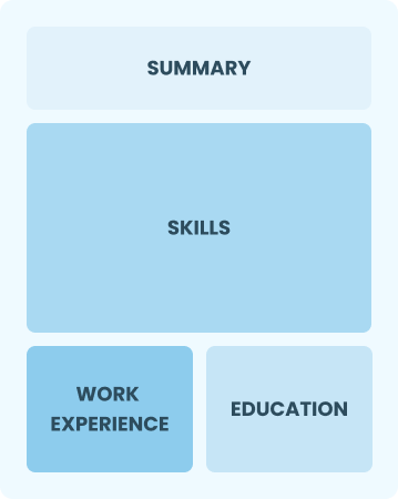
Best for:
Recent graduates and career changers with limited experience in drone piloting
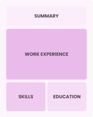
Mid-Career 3 - 7 years
Combination
Balances skills and work history equally
Best for:
Mid-career professionals focused on showing their skills and potential for growth
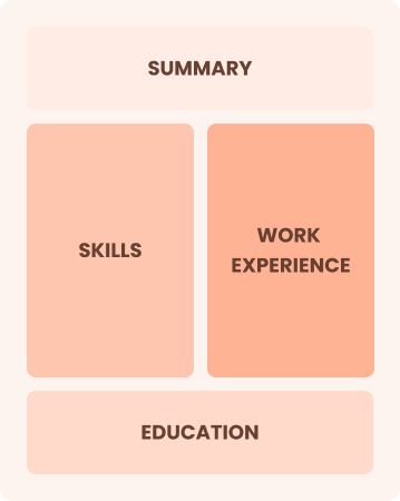
Experienced 8+ years
Chronological
Emphasizes work history in reverse order
Best for:
Experienced pilots excelling in advanced drone operations and team leadership
Frequently Asked Questions
Should I include a cover letter with my drone pilot resume?
Absolutely, including a cover letter is essential as it allows you to showcase your unique skills and enthusiasm for the drone pilot position. A well-crafted cover letter can differentiate you from other job seekers by adding depth to your resume. If you're looking for tips, consider checking our resources on how to write a cover letter or use our Cover Letter Generator to create one effortlessly.
Can I use a resume if I’m applying internationally, or do I need a CV?
When applying for jobs abroad, a CV is often preferred over a resume. Use a CV to provide detailed information about your qualifications and experience. To help you create an effective CV, explore our resources on how to write a CV and review various CV examples tailored for international applications.
What soft skills are important for drone pilots?
Soft skills like communication, problem-solving, and attention to detail are essential for drone pilots. These interpersonal skills enable effective collaboration with team members and ensure safe, precise operations in various environments, fostering trust and efficiency in their work.
I’m transitioning from another field. How should I highlight my experience?
When applying for drone pilot positions, highlight your transferable skills like attention to detail, technical skill, and teamwork. These abilities demonstrate your readiness to excel in this role, even if you lack direct experience. Use concrete examples from previous jobs to show how your background aligns with the responsibilities of a drone pilot.
Where can I find inspiration for writing my cover letter as a drone pilot?
If you're pursuing a career as a drone pilot, exploring professionally crafted cover letter examples can be immensely beneficial. These samples provide inspiration for content ideas, formatting tips, and effective ways to highlight your skills and experiences in the field.
Should I use a cover letter template?
Yes, using a cover letter template tailored for drone pilots can improve your application by offering a clear structure that helps organize content more effectively, allowing you to highlight key skills like aerial navigation and safety compliance that hiring managers prioritize.

Ready to land the job?
Join 28M+ others who've built a resume that works.