


For a business analyst, hard skills such as data analysis, skill in statistical software, and an understanding of business processes are essential for effectively interpreting data and making informed decisions.
Business Analyst Resume Examples & Templates
Looking to boost your job prospects? Our business analyst resume examples showcase how to emphasize analytical thinking and problem-solving skills that will catch employers' attention.

by Gabriela Hernandez, Last Updated: January 18, 2026
Hired By:*

- Popular Business Analyst Resume Examples
- Resume Template—Easy to Copy & Paste
- Build Your Resume in Minutes
- How to Write a Business Analyst Resume Summary
- Showcasing Your Work Experience
- Top Skills to Include on Your Resume
- Resume Format Examples
- Related Business Operations Resume Examples
- Frequently Asked Questions
- Should I include a cover letter with my business analyst resume?
- Can I use a resume if I’m applying internationally, or do I need a CV?
- What soft skills are important for business analysts?
- I’m transitioning from another field. How should I highlight my experience?
- Where can I find inspiration for writing my cover letter as a business analyst?
- How should I format a cover letter for a business analyst job?
Popular Business Analyst Resume Examples
Check out our top business analyst resume examples that emphasize critical skills such as data analysis, problem-solving, and effective communication. These examples will guide you in showcasing your achievements to potential employers.
Ready to build your own impressive resume? Our Resume Builder offers user-friendly templates specifically designed for business professionals, helping you make a lasting impression.
Recommended
 Customize This Resume
Entry-level business analyst resume
What this resume does well:
This entry-level resume for a business analyst highlights the job seeker's analytical skills and project management achievements from previous roles, focusing on their ability to drive efficiency and reduce costs. New professionals in this field should showcase their talent in data analysis and problem-solving through measurable accomplishments, even when navigating limited work experience.
Mid-career business analyst resume
What this resume does well:
This resume effectively showcases qualifications by emphasizing compelling achievements and a solid educational background. The presentation of skills and experiences illustrates the applicant's readiness for advanced roles, highlighting a proven ability to drive efficiency and cost savings in diverse projects.
Experienced business analyst resume
What this resume does well:
This resume showcases the applicant's strong analytical skills and powerful contributions, including reducing costs by 18% and boosting productivity by 22%. The use of bullet points allows for quick comprehension of significant achievements, making it ideal for hiring managers seeking results-driven applicants.
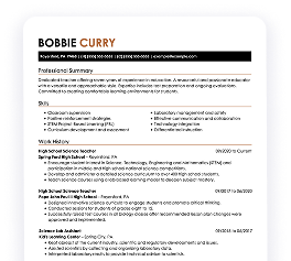
Resume Template—Easy to Copy & Paste
Example
Chris Huang
Cedar Valley, MN 55139
(555)555-5555
Chris.Huang@example.com
Professional Summary
Innovative Business Analyst with proven record in data-driven decision making and workflow optimization. Expertise in KPI development, financial modeling, and strategic planning to boost efficiency and revenue.
Work History
Business Analyst
Innovative Solutions Corp. - Cedar Valley, MN
May 2022 - October 2025
- Improved workflow efficiency by 25%
- Analyzed data trends for 1M in budget optimization
- Developed KPI metrics enhancing operational accuracy
Financial Analyst
Precision Financial Ltd. - Cedar Valley, MN
May 2020 - April 2022
- Reduced costs by 15% through data analysis
- Forecasted quarterly earnings with 92% accuracy
- Enhanced reporting system, boosting efficiency
Data Analyst
DataTech Innovate Inc. - Cedar Valley, MN
October 2019 - April 2020
- Increased data processing speed by 30%
- Identified trends yielding 10% increase in revenue
- Automated reporting, reducing errors by 40%
Languages
- Spanish - Beginner (A1)
- French - Beginner (A1)
- German - Intermediate (B1)
Skills
- Data Analysis
- Financial Modeling
- Business Intelligence
- KPI Development
- Budget Optimization
- Workflow Improvements
- Risk Assessment
- Strategic Planning
Certifications
- Certified Business Analyst Professional - International Institute of Business Analysis
- Financial Risk Manager - Global Association of Risk Professionals
Education
Master of Business Administration Business Analytics
University of Illinois Chicago, Illinois
May 2019
Bachelor of Science Finance
Northwestern University Evanston, Illinois
May 2017
Build Your Resume in Minutes
Creating a custom resume is easier than ever with our Resume Builder!
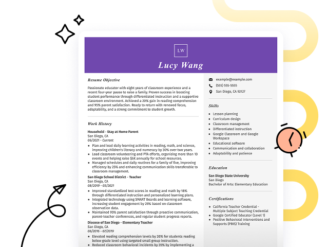
How to Write a Business Analyst Resume Summary
Your resume summary is the first opportunity to make a lasting impression on hiring managers. It's important to clearly showcase how your skills and experiences align with the business analyst role right from the start.
As a business analyst, you should emphasize your analytical abilities, problem-solving skills, and experience in translating data into actionable insights. Highlighting these aspects will set you apart from other applicants.
To illustrate what makes a powerful resume summary, consider these examples that demonstrate effective strategies and common pitfalls:
Weak Example
I am a dedicated business analyst with a decent amount of experience. I want to find a role that allows me to use my skills and help the company succeed. A position where there are chances for advancement and a supportive team is what I'm looking for. I believe I can contribute positively if given the chance.
Why this summary misses the mark:
- Lacks specific examples of skills or experiences, making it difficult to assess qualifications
- Overuses personal language, which detracts from professionalism and relevance
- Emphasizes job seeker desires instead of demonstrating potential value to the employer
Strong Example
Analytical business analyst with 6+ years of experience in data-driven decision-making and process optimization. Successfully improved operational efficiency by 20% through the implementation of a new project management system, resulting in a 30% reduction in project delivery times. Proficient in SQL, Tableau, and Agile methodologies, with strong skills in stakeholder communication and requirements gathering.
Why this summary works:
- Begins with specific years of experience and highlights key areas of expertise
- Includes quantifiable achievements that illustrate significant impacts on efficiency and delivery timelines
- Showcases relevant technical skills and competencies necessary for business analyst roles
Pro Tip
If you're short on formal experience, consider crafting a career objective instead of a summary. This allows you to highlight your goals and skills effectively. Look for tailored resume objective examples specific to business analysis to guide your writing.
Showcasing Your Work Experience
As a business analyst, the work experience section of your resume is where you'll want to focus most of your efforts. This is the centerpiece of any good resume template.
Organize this section in reverse-chronological order, using bullet points to highlight key achievements and responsibilities in each role you've held as a business analyst.
To help you craft an effective work history, we’ve prepared some examples. These will illustrate what makes an entry stand out and what might need improvement:
Weak Example
Business Analyst
Tech Solutions Inc. – San Francisco, CA
- Analyzed data and made reports.
- Attended meetings with teams.
- Used software to track performance.
- Assisted in project planning.
Why this work experience section misses the mark:
- Lacks specific projects or impacts achieved by the analysis
- Fails to include key skills or tools used effectively
- Focuses on routine tasks rather than demonstrating problem-solving abilities
Strong Example
Business Analyst
Tech Solutions Inc. – San Francisco, CA
March 2020 - Current
- Analyze business processes to identify inefficiencies, leading to a 30% reduction in operational costs within the first year.
- Develop data-driven reports and dashboards for executive decision-making, improving project visibility and prioritization by 40%.
- Facilitate cross-functional workshops that improved stakeholder engagement and alignment on project goals, increasing project success rates by 25%.
Why this work experience section works:
- Starts each bullet with effective action verbs that clarify the applicant’s contributions
- Incorporates quantifiable outcomes which demonstrate the effectiveness of the job seeker’s initiatives
- Showcases relevant skills such as data analysis and stakeholder management in context of achievements
While your resume summary and work experience sections are important, don’t overlook the other important parts of your resume. Each section contributes to presenting your qualifications effectively. For detailed guidance, be sure to explore our comprehensive guide on how to write a resume.
Top Skills to Include on Your Resume
A well-defined skills section is important for a standout resume. It allows you to quickly communicate your qualifications to potential employers, making it easier for them to assess your technical skills and see your fit for the role.
As a business analyst, emphasize technical skills such as data analysis, skill in SQL, and experience with tools like Tableau or Excel. Highlighting these specifics shows your ability to handle analytical challenges effectively.
Meanwhile, soft skills like critical thinking, communication, and teamwork abilities play a important role in collaborating with stakeholders to ensure project success.
Selecting the right resume skills is important for aligning with employer expectations and passing through automated screening systems. Companies often use these systems to filter out job seekers lacking essential skills, so it’s important to tailor your resume accordingly.
To identify which skills to prioritize, carefully review job postings. They often provide clear indications of the desired qualifications that will capture a recruiter’s interest and ensure your application successfully navigates ATS scans.
Pro Tip
Ensure your resume stands out in the digital crowd by using our ATS Resume Checker to uncover over 30 common errors and improve your chances of getting noticed by applicant tracking systems.
10 skills that appear on successful business analyst resumes
Highlighting key skills relevant to business analyst roles can significantly improve your resume's visibility to recruiters. You’ll find these in-demand skills featured in our resume examples, helping you gain the confidence needed for your job applications.
By the way, consider incorporating any of the following essential skills into your resume that align with your experience and the requirements of your target positions:
Sql proficiency
Stakeholder management
Product management
Microsoft office suite
Data analysis
Requirements gathering
Problem-solving
Analytical thinking
Workflow analysis
Decision-making
Based on analysis of 5,000+ business operations professional resumes from 2023-2024
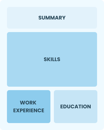
Resume Format Examples
Selecting the appropriate resume format is important for showcasing your analytical skills, relevant experience, and professional growth as a business analyst to potential employers.
Entry-Level 0 - 2 years
Functional
Focuses on skills rather than previous jobs
Best for:
Recent graduates and career changers with limited experience in business analysis
Mid-Career 3 - 7 years
Combination
Balances skills and work history equally
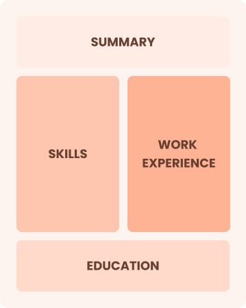
Best for:
Mid-career professionals focused on demonstrating their skills and potential for growth
Experienced 8+ years
Chronological
Emphasizes work history in reverse order
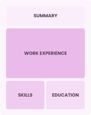
Best for:
Experienced leaders skilled in driving strategic business solutions
Frequently Asked Questions
Should I include a cover letter with my business analyst resume?
Absolutely! Including a cover letter can significantly improve your application. It allows you to highlight your relevant skills and explain why you’re a perfect fit for the position. If you're looking for guidance, our comprehensive guide on how to write a cover letter can help. Alternatively, try our easy-to-use Cover Letter Generator to craft an impressive document in no time.
Can I use a resume if I’m applying internationally, or do I need a CV?
When applying for jobs abroad, a CV is often required instead of a resume. A CV provides a comprehensive overview of your academic and professional history. To assist you, we offer various resources that guide you through how to write a CV with proper formatting and writing techniques tailored for international standards. Additionally, you can refer to our CV examples for further guidance.
What soft skills are important for business analysts?
Soft skills such as critical thinking, communication, and collaboration are essential for business analysts. These interpersonal skills help facilitate effective interaction with stakeholders, fostering understanding and teamwork, which ultimately leads to successful project outcomes and improved business processes.
I’m transitioning from another field. How should I highlight my experience?
Emphasize your transferable skills like analytical thinking, teamwork, and communication. These abilities demonstrate your adaptability and potential impact in a business analyst role, even if your background is different. Share concrete examples from your past illustrating how you tackled challenges and achieved results relevant to data analysis and decision-making.
Where can I find inspiration for writing my cover letter as a business analyst?
For aspiring business analysts, exploring professional cover letter examples can be invaluable. These samples provide inspiration for showcasing your skills and experiences effectively. They offer insights into formatting and content that can help you create a compelling narrative in your application materials.
How should I format a cover letter for a business analyst job?
To format a cover letter for business analyst positions, start with your contact details and add a professional greeting. Follow this by introducing yourself in an engaging manner that outlines your interest in the role and your relevant experience. Use specific examples from the job description to show how you meet the requirements. Conclude with a strong closing statement that encourages further discussion.

Ready to land the job?
Join 28M+ others who've built a resume that works.